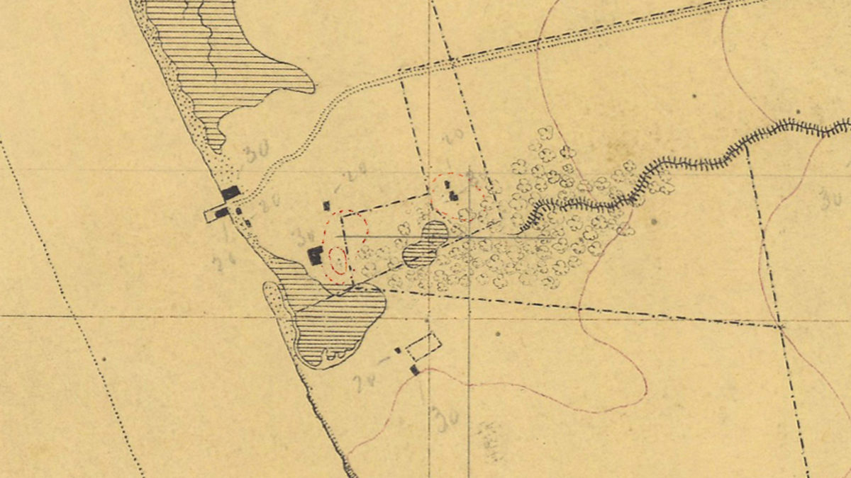
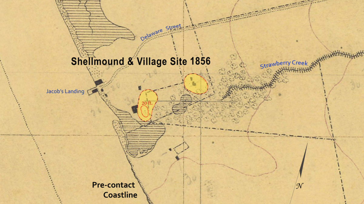
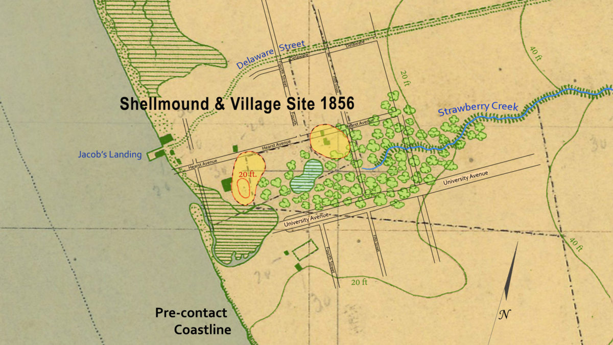
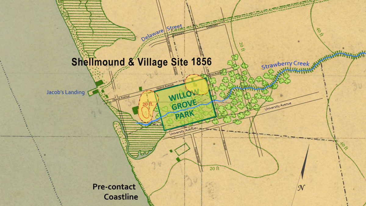
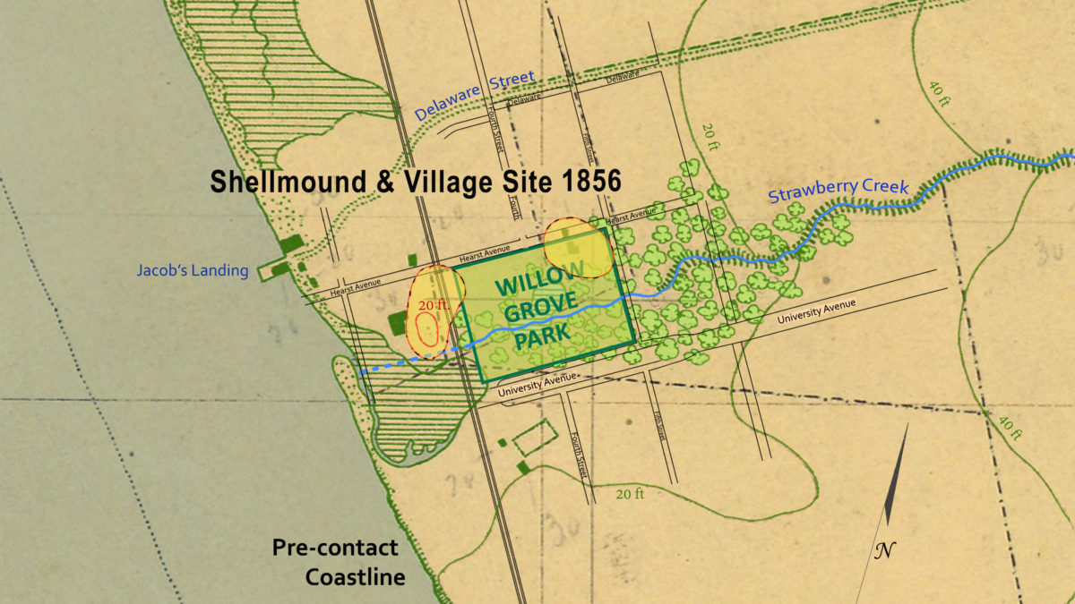
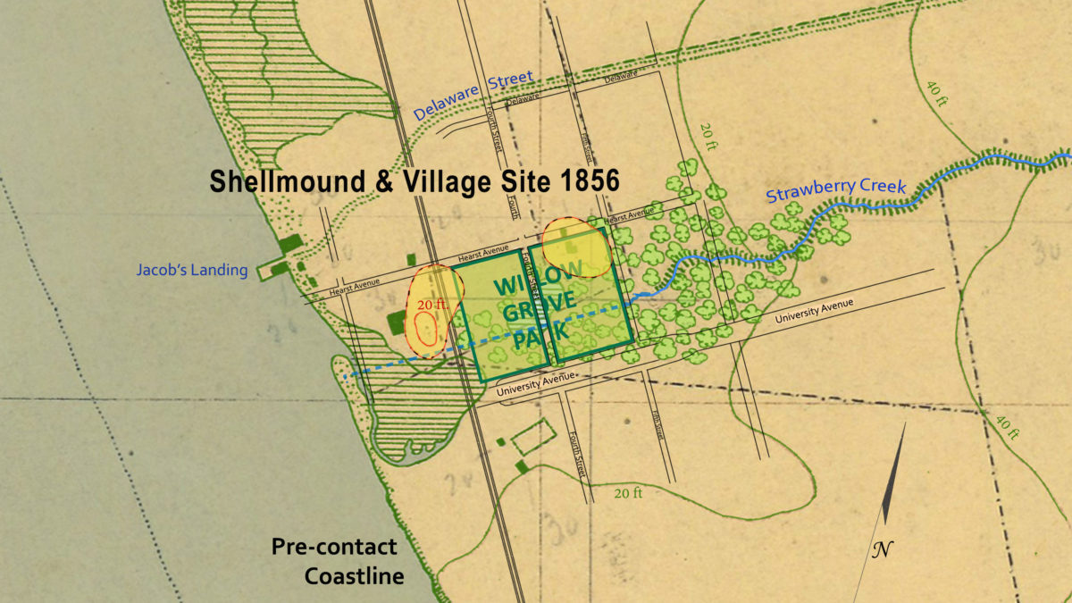
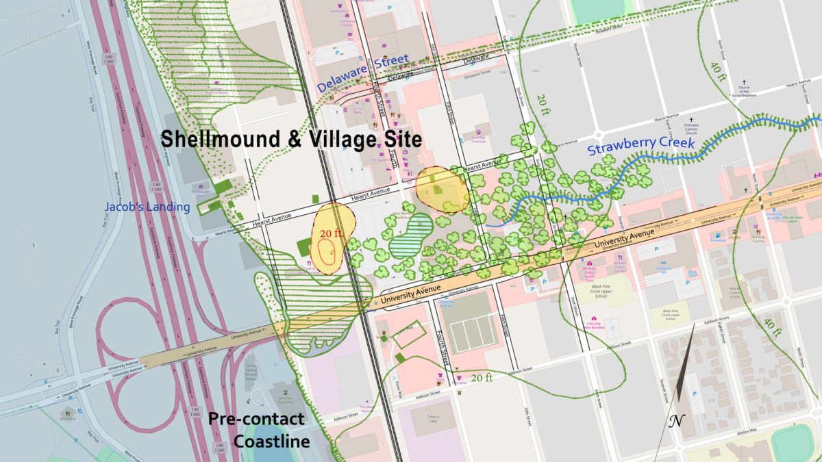
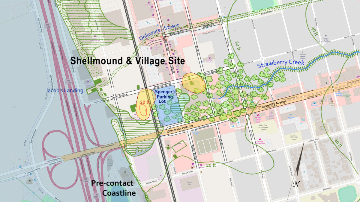
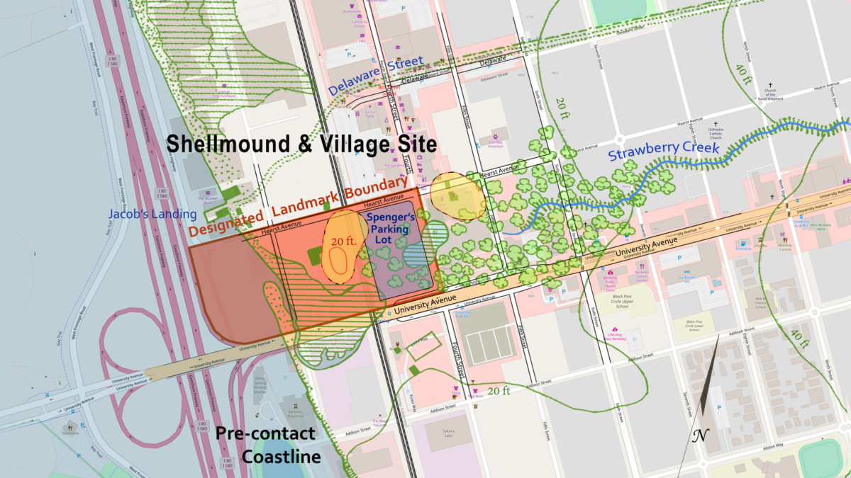
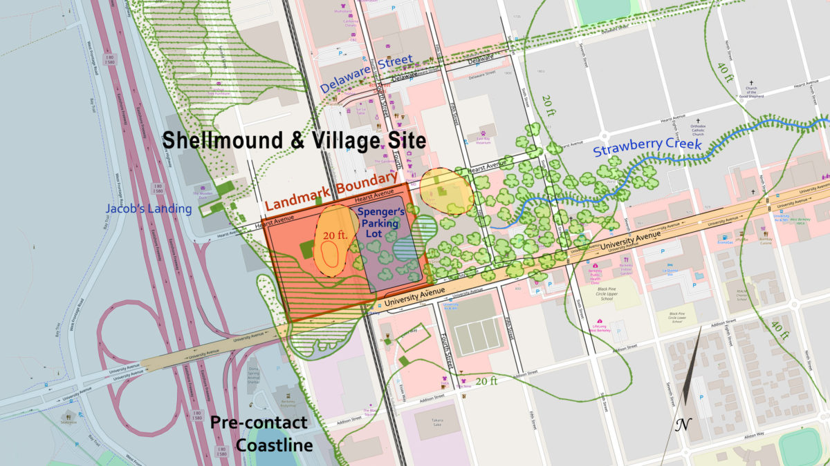
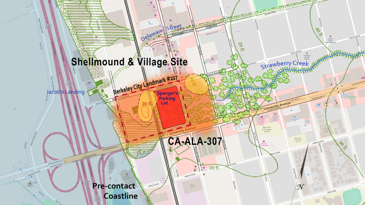
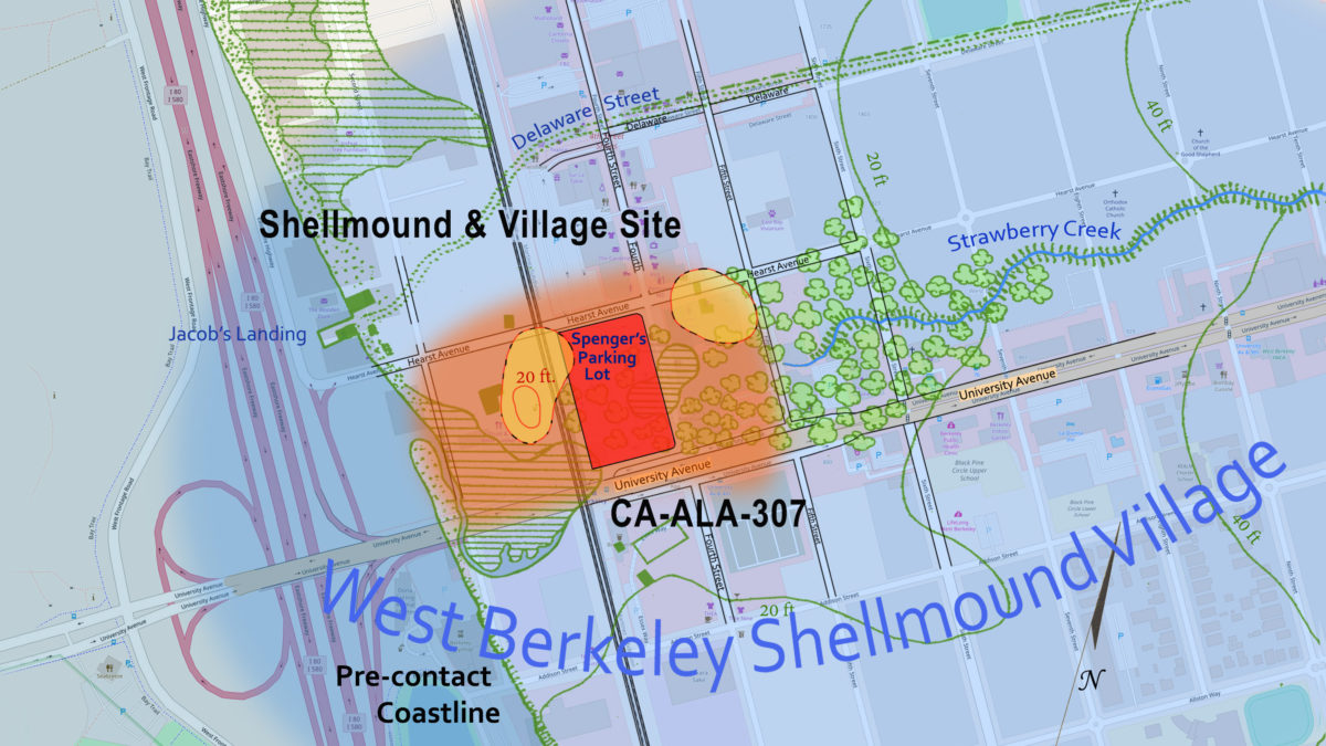
Utilizing the fine detail of the U.S. government’s 1856 Coast Survey map, landscape architect Chris Walker and filmmaker Toby McLeod set out to illustrate 150 years of changes to the landscape of the West Berkeley Shellmound through a series of 15 map overlays:
A color enhanced ecosystem shows Strawberry Creek flowing through a wetland with a meandering creek bed and the prehistoric village site with two shellmounds to the north. The 1856 base map is overlaid with Berkeley streets and the Berkeley City Landmark boundary that was designated in 2000.
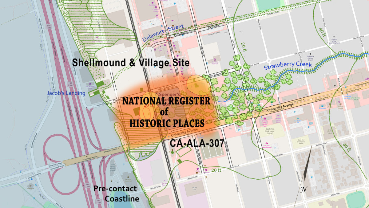
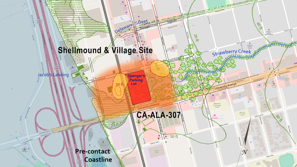
The archaeological site is officially known by the number “CA-ALA-307,” because archaeologist Nels Nelson gave the West Berkeley Shellmound #307 when he mapped 425 shellmounds around San Francisco Bay in 1904. As you tab through Willow Grove Park (1877) and the appearance of Spenger’s parking lot in the 1950s, you will eventually reach the key area shaded in orange, which was found eligible for the National Register of Historic Places in October 2003.
The site was then listed on the California Register of Historical Resources in December 2003. The two shellmounds in yellow are features within the archaeological site that fully envelops Spenger’s parking lot at 1900 Fourth Street and it is important to remember that the shellmounds rose over thousands of years at the center of the much larger prehistoric village area.
You can also download this series of maps as a PDF slideshow, for offline use.
How we made the maps
For a detailed accounting of our map assembly process, please see our blog post, How We Made the Maps.


